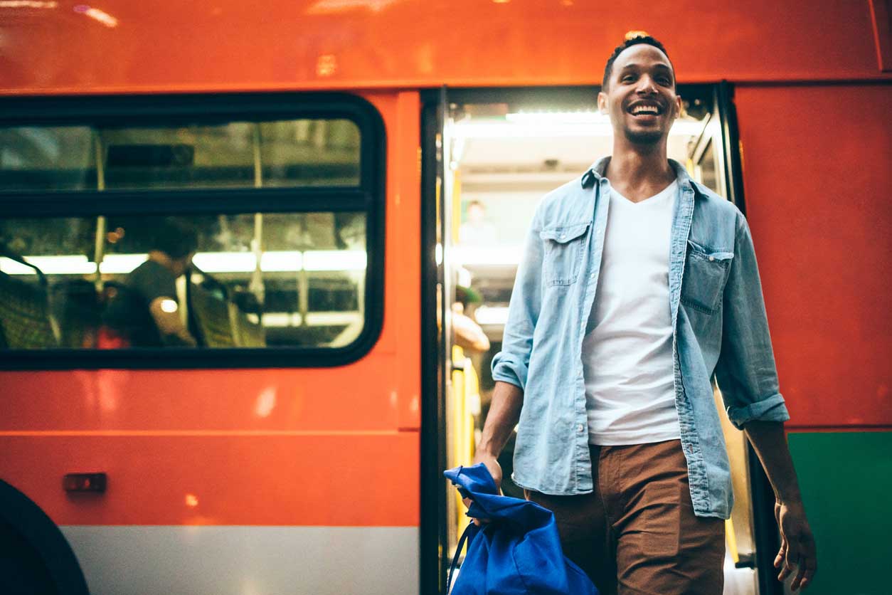
During a quick trip to Los Angeles my husband was staying at a hotel near LAX. With an afternoon to kill, he wanted to go to the beach but didn’t have a car and figured Uber or Lyft would cost an arm and a leg. I suggested the bus.
Transit nerd (and nice wife) that I am, I checked Google to see which beach town had the best, most direct bus connection. I determined that Santa Monica – while not the closest beach to the airport – is relatively easy to get to using its Big Blue Bus service. So that afternoon my husband took their route #3 bus from a stop right outside his hotel to the Downtown Santa Monica station at 4th and Colorado, which also happens to be the end of the line for Metro’s E (or Expo) rail line.
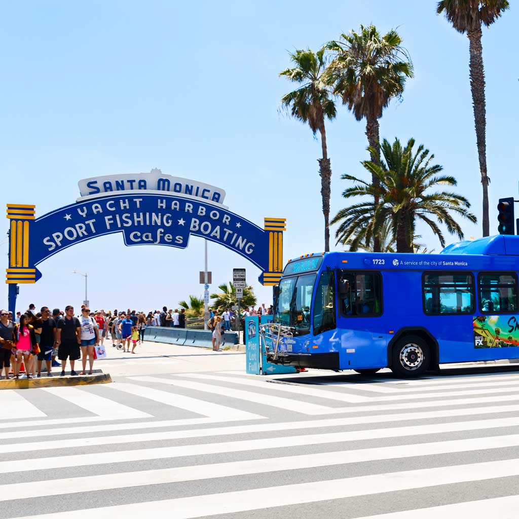
Photo credit: Big Blue Bus
The one-way cash fare on Big Blue Bus was only $1.25, and it took about 50 minutes with no transfers. An Uber might have been a little faster, but it would have cost considerably more. And because rideshare rates can vary widely based on demand, you never know what you’re in for – it could be $20, or it could be $60!
The beaches aren’t the only places you can get to by bus in LA. The city’s vast and impressive network of buses run late into the night and reach into virtually every nook and cranny of the city.
The moral of the story: Never underestimate the bus to get you where you’re going!
Why Take the Bus?
To start, consider that buses can go many places where trains cannot. Most big cities like LA have bus networks with hundreds if not thousands of stops. They carry people to the places they need and want to go, whether it’s work or school, medical appointments, shopping, cultural attractions or sports and entertainment.
While the bus may not always be the quickest way to travel from A to B (though oftentimes it is), there are many other reasons to take it.
The most obvious is its benefit to the environment. One bus has the potential to take dozens of cars off the road, reducing traffic congestion as well as harmful greenhouse gas emissions.

Speaking of traffic congestion, it’s true that buses are at the mercy of traffic just like cars, but at least someone else is doing the driving. You can sit back and relax, read a book, or catch up on emails and the news.
Taking public buses in a city like LA is also a fun way to observe the urban landscape from a higher vantage point. Think of it as an inexpensive city tour.
While I was living in LA, I rode a bus every day between my home in Hancock Park and my office downtown. For me that ride was a window into the many cultures that make LA such a fascinating place. In the span of about five miles, I traveled the globe starting in my own Orthodox Jewish neighborhood, then through Koreatown, Little Bangladesh, and several lively corners that could be anywhere in South or Central America.
There’s no question taking the bus will save you money, too. Fares are much less than rates for Uber or Lyft, and unlike those ride-hailing options, a bus fare is a known quantity. Furthermore, there are often discounts for frequent riders and specific groups of riders like seniors and students.
Overview of LA’s Buses
Metro
Since most buses in LA are run by the Los Angeles County Metropolitan Transportation Authority, or Metro, let’s start there. With 120 routes and almost 12,000 stops over 1,447 square miles, Metro’s vast network of almost 2,000 buses provides service late into the night, with some buses running around the clock. On many routes, service is so frequent, at least during peak hours, it’s unnecessary to check the schedule. The agency is also making a big push to install more bus-only lanes for even speedier service.
There are four categories of bus service offered by Metro throughout LA County:
Local buses stop around every two blocks and are painted orange.
Rapid buses are faster buses with fewer stops only at major intersections. They are painted red.
Express buses travel on routes on freeways for longer distances with fewer stops. Fares on these buses are higher than those on the regular routes.
Bus Rapid Transit (BRT) G Line (Orange) and J Line (Silver) run on dedicated bus lanes and require payment with a TAP card.
Other City Buses
Metro isn’t the only player in town. Many of LA’s surrounding cities are served by their own bus systems, including:
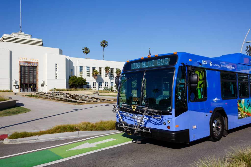
Big Blue Bus provides service in the City of Santa Monica as well as the west side of LA including Westwood, UCLA and both the City Bus Center and Metro’s Aviation rail station at LAX. Many routes, like the 3 that my husband took between LAX and Santa Monica, connect with Metro’s E Line (Expo). There’s a single express route as well that travels to and from Downtown LA.
Culver CityBus operates seven routes throughout the Westside communities of Venice, Westchester, Westwood, West Los Angeles, Palms, Playa Vista, Marina Del Rey, Rancho Park, Mar Vista, Century City, and Culver City. In addition to carrying riders to and from Downtown LA, Culver City Bus Line 6 and Rapid 6 offer an easy and inexpensive way to LAX. Both drop off at the LAX City Bus Center where you can take the free shuttle to your terminal.
Cityline buses operate throughout the City of West Hollywood (Yes, West Hollywood is its own city, even though Hollywood is part of LA!) The route generally follows Santa Monica Blvd., but also turns off into the surrounding neighborhoods. Local shuttles run approximately every 30 minutes Monday through Saturday from 9 a.m. to 5:30 p.m., and there’s a commuter shuttle that connects with the Metro B Line at the Hollywood and Highland Station during weekday rush hours and Saturdays from 5 to 8 p.m.
Foothill Transit serves the San Gabriel and Pomona valleys, including a service between Downtown LA and the city of El Monte that combines its Silver Streak bus with Metro’s J Line (Silver) bus route.
DASH provides frequent, shuttle-like service within smaller areas of downtown LA and in 27 neighborhoods across the city for just 50 cents a ride. Run by the Los Angeles Department of Transportation (LADOT), each route is designed to serve travel within that neighborhood and connect to other transit services such as Metro. Buses generally run every eight to 15 minutes seven days a week but are at the mercy of street traffic.
Beach Cities Transit (BCT) serves the popular beach communities of Redondo Beach, Hermosa Beach, Manhattan Beach, and El Segundo. All these towns are close to LAX, and BCT’s Line 109 connects with Metro’s C Line (Green) Aviation/LAX station and the LAX City Bus Center.
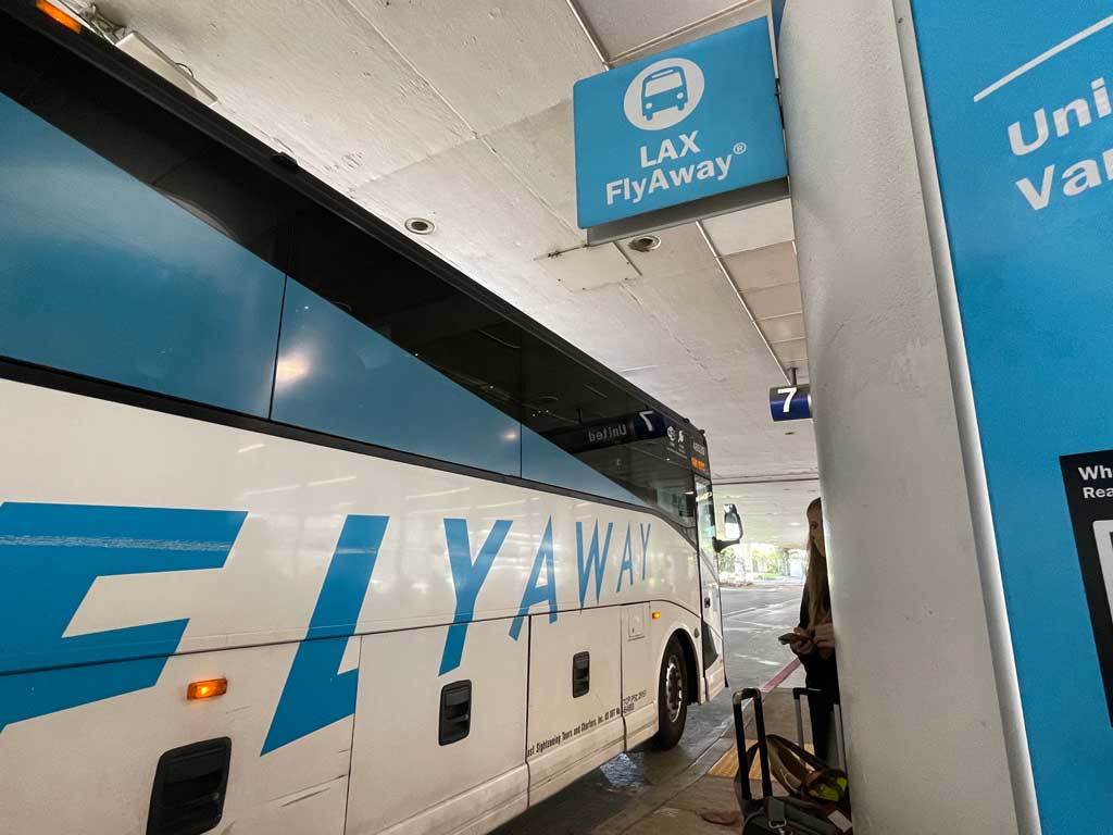
Though not really a public bus, there is the LAX FlyAway® that provides service between LAX and LA Union Station in Downtown Los Angeles as well as the Van Nuys FlyAway Bus Terminal.
The one-way fare between LAX and Downtown LA is $9.75, which you can purchase online in advance or pay with stored value on a TAP fare payment card. You can read more about this service in my article about public transit and LAX here.
NOTE: These buses have fare structures separate from Metro; however, if you have a TAP card with cash value stored on it, you can use it to pay on multiple systems. You can also take advantage of discounts when transferring from one operator to another.
Where The Bus Can Take You
As much as I love buses, I’m the first to admit that it may not always be your best travel option – it all depends on where you’re starting and where you’re going. The greater LA area is so huge that if you must change buses multiple times or travel great distances, it may not make sense. It’s a good idea to first check on Google Transit or your favorite trip planner. Just plug in your origin and destination for the day and time you plan to travel, and like me, you may be surprised how easy it is to take a bus where you’re headed.
While this only begins to scratch the surface, here are some of the places you can visit by bus in LA.
Museums
If you’re staying downtown, Dash buses, run by the LA Department of Transportation, are a great way to get around to museums like the Broad and the Museum of Contemporary Art (MOCA). Both are on Route B, which also serves LA Union Station. The Japanese American Museum, as well as the downtown Arts District, are on Dash’s Route A.
Exposition Park, where you’ll find a cluster of fantastic museums, including the Natural History Museum, the California Science Center, and the California African American Museum, is easy to reach on Metro’s E Line (Expo), but Dash’s Route F will also get you there.
During my time in LA, I was lucky enough to live near Museum Row along the mid-section of Wilshire Blvd., which stretches almost 16 miles between Downtown LA and Santa Monica. Metro’s Rapid Bus 720 travels the famous boulevard from end to end with convenient stops at the Los Angeles County Museum of Art, the La Brea Tar Pits and Museum, the Academy Museum of Motion Pictures, and further down the route, UCLA’s Hammer Museum.
Shopping and Restaurants in the Heart of LA
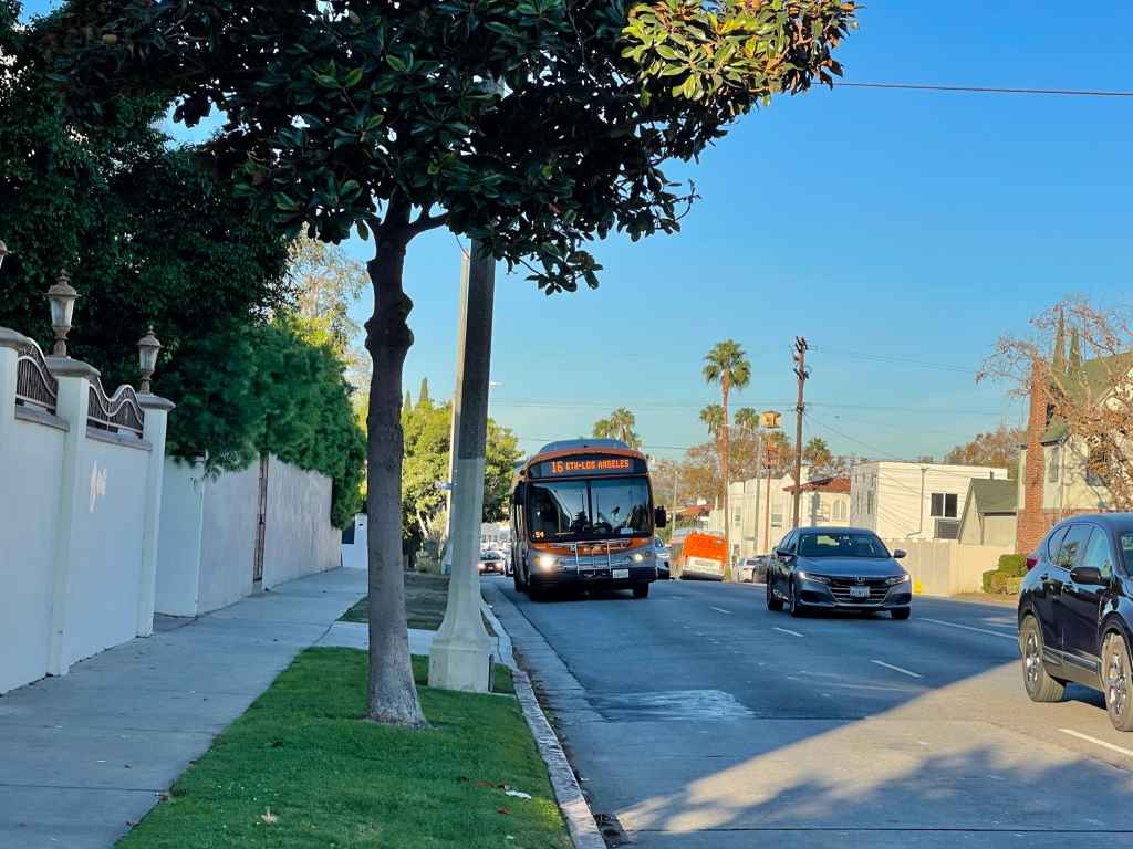
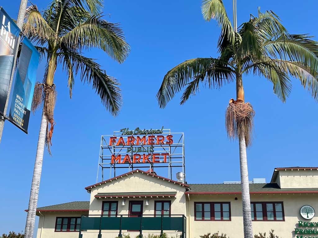
The local Metro bus I took almost daily, the 16, travels along 3rd St. between Downtown LA and West Hollywood. Some of the best shopping and restaurants in LA are along this corridor, including Koreatown, the Grove and Original Farmers Public Market, and Beverly Center.
Also connecting Downtown LA to West Hollywood is the Metro 10 bus. This bus originates by the Fashion District, travels through the downtown area, including Pershing Square, and eventually makes its way along Melrose Ave. and into the heart of West Hollywood.
Another great thoroughfare in the heart of LA, Santa Monica Blvd., is served by Metro’s 4 local and 704 Rapid. Both follow the boulevard from 5th St. in Santa Monica until it merges with Sunset Blvd. in the trendy Silver Lake neighborhood, not far from Downtown LA.
Dodger Stadium
Angelenos may love their Dodgers, but they have little affection for driving to and parking at Dodger Stadium. To provide some relief, Metro runs a free shuttle to and from home games called the Dodger Express. It picks up fans at Union Station downtown, as well as several stops in the South Bay, with service starting about two hours before the first pitch. Return service ends 45 minutes after the final out or 20 minutes after post-game events.
The Beaches
And then there are the beaches. Admittedly, this was the one place my husband and I usually drove to, in part because we lived on the east side of the 405 freeway, but mainly because we had stuff like beach chairs and towels in tow.
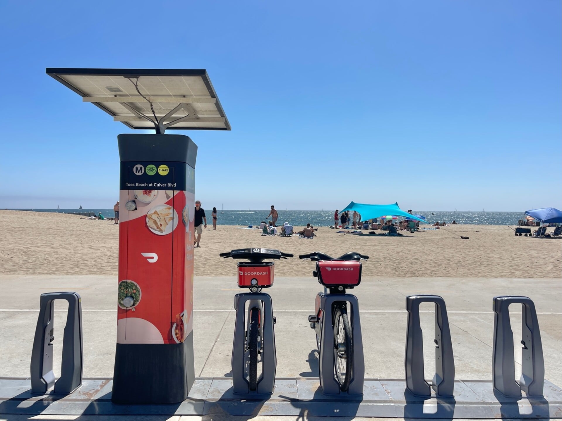
Still, if you’re flying into LAX and you really don’t want to have a car, it’s possible to get to many of the most popular beach towns on the South Shore – Manhattan, Hermosa, and Redondo – by bus since they are all so close to LAX. Once there you can bop around using Beach Cities Transit, or my favorite, by biking along the paved coastal path called the Strand, which you can read about on my blog here.
The beaches further north are trickier, especially Malibu, but as I mentioned at the start of this article, Santa Monica is an easy ride on Big Blue Bus route 3 from the airport, or you if you’re starting in Downtown LA, you can bypass all the traffic on the 10 freeway by taking Metro’s E Line.
Obviously, there are many, many more places to get to by bus in LA, but you get the picture.
Paying Your Fare
The bus fare you pay depends on the agency you’re using and whether you are eligible for a reduced fare. As a point of reference, the regular adult fare for LA Metro is $1.75 and is good for two hours of unlimited transfers in one direction.
There are several ways to pay your fare. The easiest and most economical is with the TAP card. It’s available for $2 online, at Metro ticket vending machines, many retail locations, and Metro Customer Centers. You can also download the TAP app on your iPhone or Android smartphone.
Even though the TAP card is accepted at 26 agencies across LA County, these agencies may have different policies regarding transfers and discounts, so it’s always best to check in advance. Also note that if you plan to ride across multiple transit systems, you need to have stored value or an EZ transit pass on your TAP card. You can’t, for example, use an agency-specific discount pass to pay another agency’s fare.
If you’re only in town for a brief stay and don’t have or want to get a TAP card, you can just pay your fare when you board the bus. The only catch here is that in most cases you’ll need exact change. Unlike trains where you can usually buy a ticket at the station with a debit or credit card, most bus stops don’t have ticket machines, and the drivers are not equipped to accept debit or credit cards or make change.
Fare Capping on Metro
Metro has a fare capping program in which you never pay more than a certain amount for rides within a specific timeframe – either one day or seven days. Once you hit that amount, called a “cap”, all rides on Metro buses and trains are free within the specified timeframe. Fare capping only works if you pay with a TAP card or Apple Wallet.
Tips for Riding the Bus
Plan Your Trip in Advance: Before you set out, use an online trip planner to scope out your trip. I like to use Google Transit to see what options are available and how long it will take. After you type in your origin and destination and click “Directions”, be sure to update the time of travel from “Now” (unless of course you are traveling right away), to whatever date and time you plan to travel. You can choose to set either a desired departure time or desired arrival time. By doing this, you will get the most accurate schedule for the day and time you plan to be riding the bus.
In addition to Google Transit, I usually doublecheck the schedule on the transit agency website and make note of where my bus stops are on both ends of the trip. I also make note of the bus stop right before my destination bus stop, so I know when I need to prepare to get off.
Know How You’re Going to Pay: Before embarking on your bus journey in LA – or anywhere for that matter – check the fare and know how you plan to pay. You don’t want to be scrambling at the last minute, so either get enough cash to pay both ways or purchase a TAP card.
Get to your stop early: Especially if it’s your first time taking a particular trip, arrive five to 10 minutes early and wait away from the curb but somewhere where the driver can see you. As the bus approaches, wave for it to stop or at least make yourself visible if there aren’t more people waiting with you. Check the head sign above the windshield for the route number and destination to ensure it’s your bus.
Don’t Be Afraid to Talk to the Driver: Taking the bus to an unfamiliar place can be intimidating. If you’re not sure where you need to get off, ask the driver in advance and even sit up close to the driver if it makes you feel more comfortable. Let them know your stop and ask them to give you a heads up when they’re getting close.
Use Real-Time Data: In an ideal world, buses come on schedule. Unfortunately, delays happen, and you may not be able to rely on the scheduled arrival times. That’s where technology comes in! To alleviate the frustration of waiting at a stop and not seeing your bus arrive when it’s supposed to, you can use real-time data to see when your bus will be arriving. Some bus stops have digital signs that display this information, or there’s a number, called a stop ID, that you can text or call to obtain the next arrival time.
I sometimes use real-time information while I’m on the bus to know when I’m getting close to my stop. I simply plug in my origin and destination into the trip planner (if it isn’t already), display the map, and voila, I can follow along my route in real-time.