With 48 named hills, San Francisco is home to some of the world’s most stunning panoramas, and there’s no shortage of popular spots to take them in. For a fresh perspective enjoyed mainly by locals, check out these lesser-known urban peaks.
Corona Heights Park
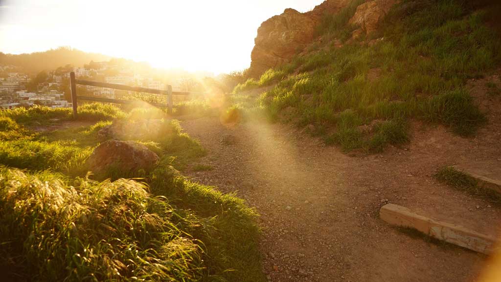
Cottage-style homes you’d expect to find in a seaside village surround this park, located in the affluent Corona Heights neighborhood close to the Castro. The park is shadowed by a craggy hill that rises over 200 feet from its base bound by Flint St. on the east, Roosevelt Way to the north, and 16th St. to the south.
The hike to its barren, wind-blown summit may leave you breathless, but rewards with an unobstructed, nearly 360-degree view of San Francisco – from downtown City Hall to Twin Peaks, and on a clear day, straight over to Oakland on the other side of the San Francisco Bay.
If you have kids, you can make an afternoon of it at the Randall Museum and Corona Heights Playground. There’s a sizable play area for dogs at the hill’s base.
After the steep climb, head down to the Castro for a bite to eat.
Access: Corona Heights can be accessed from Flint St. at the west end of 16th St. and is just two blocks from the Castro Muni station. There’s also street parking along Roosevelt and Museum ways, which can be reached via Upper Terrace from Masonic Ave.
Buena Vista Park
Photo credit: Kars Alfrink on Flickr
Not far from Corona Heights is another peak offering postcard views of the city. This hill is part of Buena Vista Park, established in 1867, making it the oldest official park in San Francisco. Together, the hills of Buena Vista and Corona Heights connect the Castro and Haight/Ashbury districts.
Buena Vista is forested and lush, with paths meandering through oaks, redwoods, pine, cypress, and eucalyptus. There are several ways to reach the summit, with exceptional views along the way, and all ultimately leading to the granddaddy panorama of all, encompassing the Golden Gate Bridge and Marin Headlands.
A grassy knoll at the top is a popular spot for dogs (and their owners) to meet and greet, and there are “hidden” tennis courts that locals would prefer stay under wraps. For a full dose of San Francisco, combine this urban retreat with lunch, shopping, and people watching along Haight St.
Access: The easiest access to the park is via the steps and sprawling lawn off Haight St. across from Lyon St. You’ll find a shorter climb by parking and entering along Buena Vista Ave. off Upper Terrace.
Tank Hill
Photo credit: apasciuto on Flickr
Named for an old water tank that was built on its summit in 1894, Tank Hill rivals the nearby tourist mainstay of Twin Peaks for its arresting panorama. It’s a small peak, with not a lot to do at the top except nestle into one of the rocky outcroppings to enjoy what some say is the very best view of the city.
Like Twin Peaks, the view encompasses 360 degrees of San Francisco’s finest sights, including both bridges, the Presidio, Golden Gate Park, and downtown. Of all the San Francisco summits, this is generally the least crowded (except during the July 4th fireworks), and offers a quiet retreat from the urban buzz.
For nature lovers, Tank Hill is home to an impressive array of native plants and flowers, as well as two species of endangered butterflies.
Access: The easiest way to get to the summit is via a stairway at Twin Peaks Blvd. and Clarendon St. There’s also an entrance from the east end of Belgrave Ave. off Stanyon Ave.
Bernal Heights Park
Bernal Heights Park is a dog-owner’s paradise in the heart of the charming and now pretty upscale Bernal Heights neighborhood.
From the park, you’re high enough to see the Golden Gate Bridge and Marin Headlands to the north, the Bay Bridge and East Bay Hills to the east, and site of the old Candlestick Park to the south, yet low enough to appreciate the contours and textures of the city’s distinct enclaves, including downtown/Civic Center, the Mission, Noe Valley, and Bay View.
The park sprawls between two summits, and narrow dirt paths gently wind around them, cutting through acres of grass highlands. The fenced-in antenna tower atop the higher and steeper peak is an unfortunate addition to the landscape, but doesn’t distract from the stunning views.
Finish off your sight-seeing with a stroll along Cortland Ave., Bernal Heights’ main drag, where you’ll find unique shops and intimate cafes, bars, and restaurants.
Access: From Cesar Chavez St., turn onto Folsom St. and then take a right onto Buena Vista Park Blvd. which winds up to street parking at two trailheads. There’s also a route leading from Mission St. to public staircases built into the neighborhood streets, and a number of paths to the hill cutting over from Cortland Ave.
Grandview Park (Turtle Hill)

Photo Credit: John Weiss on Flickr
This tiny hill park in the Sunset District between Golden Gate Park and Ocean Beach is crowned with Monterey cypress trees and a small bench from which one can enjoy views of downtown San Francisco, Golden Gate Park, the Pacific Ocean, the Marin Headlands, and Sutro Tower.
Also known as Turtle Hill, Grandview Park provides one of the last remaining habitats within the city for a number of native plants, including the Franciscan wallflower, dune tansy, bush lupin, bush monkey flower, and coyote bush.
The Inner Sunset is a thriving foodie hub. After your visit, head over to nearby 9th Ave. and Irving St. where you’ll find a wide and eclectic selection of restaurants.
Access: The wooden staircase that zig zags to the summit starts at Moraga and 14th Ave. For an added treat, park instead on 16th Ave. at Moraga and take the beautiful mosaic stairway up to 14th. Consisting of 163 mosaic-paneled steps created and sponsored by hundreds of neighbors, the Moraga Steps is a popular photo spot, especially for tourists.
3 comments
Karen, on a trip to San Francisco a few years ago, we discovered an amazing set of murals by Diego Riveria in what is now an art school. Walking around we also found incredible views of the city from the courtyards at the school. I am sure you can come up with the location quicker than I can, but it was another secret site I want to return to next trip. I think near the top of Lombard street area.
Yeah, my husband knows of it, but not sure of exact location. It’s Russian Hill though. I’ll have to find it next time I’m in the city.
Hi Karen,
This is fascinating. And I found the information on the Diego Riveria murals. I shall have to explore and find them! This is the website that identifies the different murals and how to find each one.
http://traveltips.usatoday.com/visit-diego-rivera-murals-san-francisco-11763.html
Comments are closed.